By Linda Batchelor
Two hundred and thirty years ago, on 12th August 1795, the Hydrographic Office of the Admiralty was established and Alexander Dalrymple was appointed as the first Hydrographer to the Admiralty by A Royal Warrant of George III. The world’s first hydrographic service, the Depot des Cartes et Plans de la Marine, had been established in France in 1720. In 1784 Denmark set up the Royal Danish Nautical Chart Archive to be followed by other countries including Britain, Spain and America setting up services to support their growing naval power.
In establishing such a service the British Government reflected the emerging need of the British Navy for a distinct and specialised hydrographic service to ensure the mobility and security of its ships. As empires and trade expanded so too did the need for accurate nautical charts and maritime surveying. Hydrography, collecting data on underwater topography and monitoring and observation of features of the seabed, became an important aspect of navigation and marine cartography.
Portolan Charts
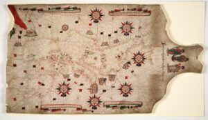
Some of the earliest sea charts are known as Portolan charts. These charts originated in the Mediterranean regions from the thirteenth century. the name derives from the Italian word ‘portolano’ meaning a collection of written sailing directions and the charts are graphic representations of such sailing directions. These were single charts hand drawn on vellum and some of the earliest were produced by Genoese, Venetian and Catalonian practitioners. Features often contained in the charts were compass roses, place names and images of landmarks and scales of distance. The purpose of the charts, reflecting conditions and reference points experienced by mariners, was to inform about coastal navigation. They were designed to be used at sea with the use of a compass and- they are characterised by rhumb lines which are diagonal lines drawn on the charts emanating from the thirty-two points of the compass. Whilst there was a practical purpose to the charts and they were of considerable value, sometimes including monetary, to seafarers, decorative copies were often presented by their creators or institutions to eminent figures such as a monarch, a pope or a major officer of state. The charts were in popular use until the eighteenth century.
The Mercator projection
In 1569 the Flemish cartographer, globe and instrument maker Gerardus Mercator, created a world map based on straight rhumb lines using his projection. This mathematical projection allows for a representation of a curved surface, such as the earth, to be rendered as a flat surface on a map. This device was well suited to navigation purposes, especially as open ocean sailing and exploration developed, and it allowed for courses and bearings to be plotted in a straight line with the aid of a compass.
Chart Making
By the early 1500s many European naval powers were producing sea charts and some such as Spain and Portugal had set up state controlled production. England was late in joining the trend towards domestic production of charts and until the 1580s relied on imported charts and chart makers. Indeed before that time despite the expansion of ocean based trade and territory English mariners were also often dependent on the knowledge of pilots from elsewhere in Europe such as Spain, Portugal and France. Towards the end of the century however because of wars with Spain and to match the French and Dutch expansion of maritime trade it became important to produce charts and sailing directions in England.
A ‘school’ of chart makers grew up in London, active from about 1590 until the mid 1700s. They worked in areas around the River Thames and their premises were often indicated by a ‘Signe of the Platt’, the word ‘platt’ meaning plot or chart. Although they worked individually they trained apprentices in their work and were often members of the Drapers Guild which had originated as a powerful wool and cloth guild dealing with domestic and overseas European trade. They tended to follow the practices of portolan chart making but with distinctive features. Charts were produced on vellum but were simpler and less decorated than the traditional Mediterranean form and did not use the Mercator Projection.
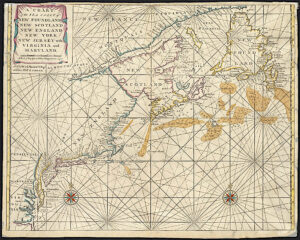
At about the same time as the Thames school emerged engraved charts printed on paper were introduced in the Netherlands. Lucas Jansz Wagenhaer, the Dutch master pilot published his Sea Atlas in this medium in 1584 which covered charts and sailing directions for many western European ports.
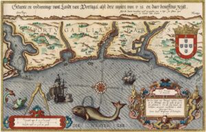
Map of Portugal 1584. Lucas Jansz Wagenhaer Sea Atlas. Arlington Library. University of Texas.
Surveying
As more areas of the oceans became charted the need for hydrography, maritime surveying and the recording of data acquired, also grew. One of the early hydrographers was Captain Greenville (Grenville) Collins who published the first comprehensive survey of the coastal waters of England and Scotland in Great Britain’s Coasting Pilot published in 1693. Captain Collins, who styled himself as Hydrographer in Ordinary to the King, was born in Chichester in 1643. He had a distinguished naval career and commanded the Royal Yacht Merlin. He had gained the attention of Charles II for the surveying work on various voyages he had undertaken and in 1681 he was able to gain royal support for a programme of surveying using Merlin which provided accurate and comprehensive charting of British waters.
The charting and surveying of domestic and coastal waters led onto more ocean charting especially as the European powers began to explore and expand their territories. Until the mid 1500s English sailors were largely reliant on Portuguese, Spanish and French pilots for overseas voyages, especially to the New World, but by the 1640s the English had gained self sufficiency in that respect. A century later Britain was a major maritime power with a reputation for being active and expert in all naval operations and the navy undertook various voyages of exploration, charting and surveying.
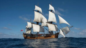
In 1768 the Royal Navy purchased a Whitby collier for a scientific mission to the Southern Ocean to observe the transit of Venus, vital to astronomy and navigation and also to search for and claim Terra Australis Incognita for Britain. Refitted and renamed His Majesty’s Bark Endeavour the ship was commanded by Lieutenant James Cook who had served first in merchant ships and then in the Royal Navy as a Sailing Master, the officer responsible for all matters of navigation. On that voyage having observed the transit Cook and his crew proceeded South reaching New Zealand and Australia. With his vast experience in navigation, charting and surveying Cook conducted accurate and detailed mapping and surveying of 2,400 miles around the coastline of New Zealand and 2,000 miles of the east coast of Australia which he claimed as British territory.
Trust in God and an Admiralty Chart
Over the next hundred years British naval and maritime undertakings expanded and grew. This expansion led to developments in navigation, chart making and surveying of domestic and overseas waters including the establishment of the Admiralty’s Hydrographic Office in 1795.
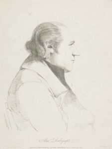
At the same time Alexander Dalrymple F.R.S. was appointed as the first Hydrographer to the Admiralty. Dalrymple was a Scottish geographer and hydrographer who had been with the East India Company since the age of sixteen in the near and far East. He had learnt navigation and became Hydrographer to the Company advising on its shipping, its trading routes and expansion and surveying and publishing charts. In his role as Hydrographer to the Admiralty it was intended that Dalrymple would be responsible for supplying charts to the Royal Navy and he was given the task of organizing and cataloguing the Admiralty’s existing survey material. Before his appointment the officer responsible for navigation on an individual warship in the Royal Navy was required to update charts and undertake surveying but this function was to become centralized in the Hydrographic Office. The first Admiralty chart of Quiberon Bay was supplied in 1801 and there was publication of Sailing Directions and Notices to Mariners. In 1819 permission was given to sell Admiralty charts to the Merchant Marine.
Dalrymple remained in office until 1808. He was succeeded by Thomas Hurd, a captain in the Royal Navy and an experienced hydrographic surveyor with an interest in science and connections with other specialists who were scientifically orientated such as Captain Matthew Flinders, Captain Francis Beaufort and Captain John Franklin. During Hurd’s time in office the surveying service of the Royal Navy came under the direction of the Hydrographer and Hurd established the principle that ships deployed for hydrographic purposes should be manned by specialist survey officers, skilled in navigation and pilotage. Hurd was followed as Hydrographer in 1823 by the noted Arctic explorer Captain William Parry who encouraged reciprocal co-operation with other hydrographic services especially those of Denmark, France and Spain.
In 1829 Captain Francis Beaufort was appointed and the importance of systematic surveying and charting for navigation and the activities of the Hydrographic Office increased. The Hydrographic Office became an Admiralty department in 1831 and by 1855 the Chart Catalogue listed 1,981 charts with 64,000 copies issued to the Navy. Beaufort was responsible for the development of the scale for wind strength and the publication of Official Tide Tables and for the direction of voyages of exploration such as the survey of South American waters by Captain Fitzroy in HMS Beagle (with Charles Darwin as part of the expedition).
In the nineteenth century the surveying and chart producing skills were refined and the Royal Navy provided a specialist and professional core of survey officers and naval vessels to support those tasks. At that time the Hydrographic Office itself was a relatively small organization with an office at the Admiralty in London.
During the twentieth and twenty first century the organization developed much further. In 1941 during World War II chart printing was moved to offices in Taunton, Somerset, and in 1968 the compilation staff were all transferred to Taunton to offices which included the Dalrymple Building. As the hydrographic role was subject to various developments, commitments and technical innovations a new structure was required and in 2001 the role of the Royal Navy and the United Kingdom Hydrographic Office became disassociated.
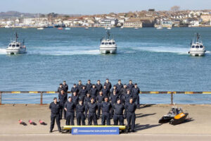
The Royal Navy Hydrographic unit now supplies the operational needs of the navy. The Hydrographer to the Navy is now a senior naval appointment and the service is based at Devonport Naval Base alongside the Hydrography School. The unit has the use of survey boats and surface and subsurface autonomous vehicles and since 2025 has the Hydrographic Exploitation Group (HXG) conducting survey and hydrographic operations using rapid deployment teams to support frontline operations and defence purposes.
Since 2019 the United Kingdom Hydrographic Office (UKHO) has had new headquarters in Taunton which houses over nine hundred staff of specialist teams and leading experts in hydrography. It is headed by the first female leader in the history of the service, Vanessa Blake, appointed as CEO in 2025.
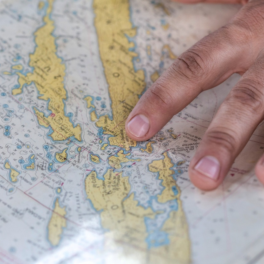
The Office is an executive agency of the Ministry of Defence which is self funding. The UKHO Archive represents one of the most complete maritime collections of historical records and documents of its type in the world. The Office provides a world leading service in hydrographic and marine geospatial data not only to the Royal Navy but also to mariners and maritime bodies throughout the world and makes a major and an important international contribution to maritime safety and knowledge.
For centuries hydrography, the science of mapping, measuring and describing the physical features of the oceans, has developed to enable charting of the world’s waters and to ensure safe and efficient navigation.
The Bartlett Blog is researched, written and produced by volunteers who staff The Bartlett Maritime Research Centre and Library of National Maritime Museum Cornwall. This blog post was written by Linda Batchelor, a Bartlett Library volunteer.
The Bartlett Maritime Research Centre & Library holds a Collection of over 20,000 volumes and offers access to one of the finest collections of maritime reference books, periodicals and archival material. The Bartlett Blog reflects the diversity of material available in The Bartlett Library.
National Maritime
Museum Cornwall Trust
Discovery Quay
Falmouth Cornwall
TR11 3QY
View Map
See our opening hours
Tel: +44(0)1326 313388
Email: enquiries@nmmc.co.uk